
11 PM Update | Tropical Depression 5 Forms
Just before 11 PM the National Hurricane Center determined that Invest 93L had a defined circulation and upgraded the system to Tropical Depression 5. TD 5 is presently located 80 southeast of the Southernmost Cape Verde Islands off the west coast of Africa moving West Northwest at 14 mph with maximum sustained winds of 35 mph. The estimated minimum central pressure 1008 mb.
A tropical storm warning has been issued for the southern Cape Verde Islands.
Tropical Depression 5 is currently in an area with favorable conditions for intensification. However, TD 5 will be moving toward an area of cooler sea surface temperatures and dryer air which will team up and weaken the system in the 3-5 day range. The intensity forecasts shows intensification to a tropical storm overnight and peaking at 60 mph in a few days before weakening due to the less favorable environment.
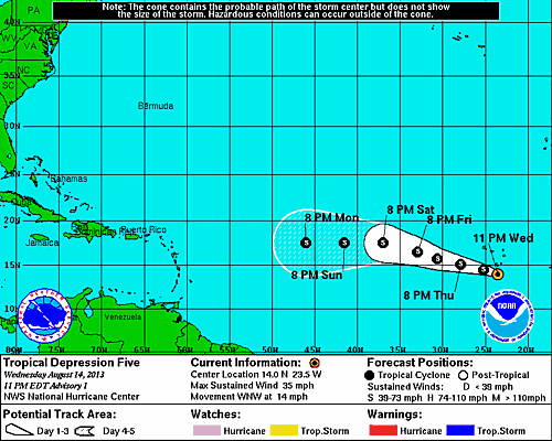
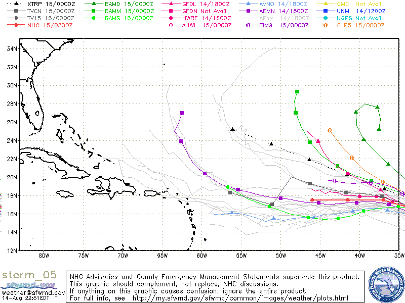
The initial forecast track from the NHC shows TD 5 turning to the west Saturday night. The initial spaghetti models are not in agreement.
System History
| Date | Time | Classification | Max Winds (mph) | Movement/Speed | Pressure (mb) |
| Aug 14 | 11 PM EST | Tropical Depression | 35 | WNW at 14 mph | 1008 |