
5 PM Update Dorian is Done (Again)
Tropical Depression Dorian had degenerated into post tropical cyclone and continues to move to the Northeast at 16 mph with maximum sustained winds of 30 mph. The minimum central pressure remains 1013 mb. The system is expected to dissipate early Sunday morning.
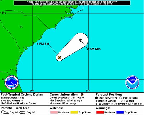
This update represents the last forecast that will be issued by the National Hurricane Center marking the official end of Dorian.
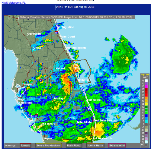
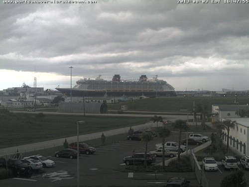
Although, Dorian may be gone, strong thunderstorms remain in the area of Port Canaveral. I can hear the thunder while watching Disney Fantasy sail away on the Port Canaveral webcam.
11 AM Update Tropical Depression Dorian Expected to Weaken Later Today
Tropical Depression Dorian continues to move Northeast at 14 mph with maximum sustained winds of 35 mph. The minimum central pressure is holding at 1013 mb. The center of circulation has moved to the north and is presently located approximately 200 miles East of Jacksonville, Florida. There are still NO coastal watches or warnings in effect at this hour, nor are any expected as the tropical depression will eventually take a turn to the east later this evening and head out to sea. In fact, the National Hurricane Center estimates Dorian degenerating later today into a remnant low (again) and fully dissipate in 48 hours.

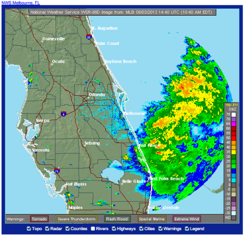
While the center of circulation is well to the north, an area of thunderstorms producing heavy rain remains offshore to the East of Port Canaveral.
5 AM Update Remnants of Dorian Regenerate East of Florida
The remnants of Dorian just will not go away. Early this morning, Invest 91L regenerated into a tropical depression moving North at 6mph with maximum sustained winds of 35 mph. The minimum central pressure is relatively high at 1013 mb. As of early this morning the system was located approximately 85 miles North-Northeast of Cape Canaveral (Port Canaveral). I would imagine this system made for a fun return for the Disney Fantasy.
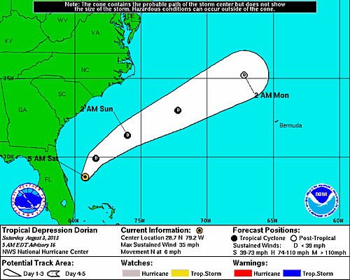
The models are in agreement and the system is expected to remain well offshore and eventually absorbed by a front moving into the Atlantic. There are NO coastal watches or warnings in effect at this hour. The current intensity forecast shows Tropical Depression Dorian has peeked in terms of maximum wind speed.
System History
| Date | Time | Classification | Max Winds (mph) | Movement/Speed | Pressure (mb) |
| July 24 | 5AM EST | Tropical Depression | 35 | WNW at 20 mph | 1008 |
| 11AM EST | Tropical Storm | 50 | WNW at 21 mph | 1002 | |
| 5PM EST | 50 | WNW at 20 mph | 1002 | ||
| 11PM EST | 50 | WNW at 20 mph | 1002 | ||
| July 25 | 5AM EST | 60 | WNW at 17 mph | 999 | |
| 11AM EST | 60 | WNW at 17 mph | 999 | ||
| 5PM EST | 60 | WNW at 18 mph | 999 | ||
| 11PM EST | 50 | WNW at 20 mph | 1001 | ||
| July 26 | 5AM EST | 50 | WNW at 20 mph | 1001 | |
| 11AM EST | 50 | WNW at 21 mph | 1006 | ||
| 5PM EST | 45 | W at 22 mph | 1010 | ||
| 11PM EST | 40 | W at 22 mph | 1010 | ||
| July 27 | 5AM EST | 40 | W at 22 mph | 1011 | |
| 11AM EST | 40 | W at 23 mph | 1011 | ||
| 5PM EST | DISSIPATED | ||||
| July 28 | Invest 91L | ||||
| July 29 | Invest 91L | ||||
| July 30 | Invest 91L | ||||
| July 31 | Invest 91L | ||||
| Aug 1 | Invest 91L | ||||
| Aug 2 | Invest 91L | ||||
| Aug 3 | 5AM EST | Tropical Depression | 35 | N at 6 mph | 1013 |
| 11AM EST | 35 | NE at 14 mph | 1013 | ||
| 5PM EST | Post Tropical Cyclone | 30 | NE at 16 mph | 1013 | |
| 11PM EST |