
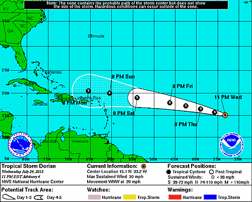
11 PM Update – Tropical Storm Dorian Continues West Across the Atlantic
Tropical Storm Dorian is being pushed west-northwest across the Atlantic ocean this evening by the trade winds at 20 mph. TS Dorian is located approximately 615 miles west of the Cape Verde Islands. The pressure continues to hold at 1002 mb with maximum sustained winds of 50 mph with tropical storm force winds reaching out 45 miles from the center of circulation.
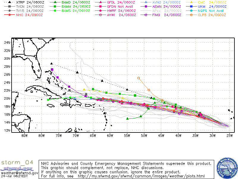
Over the past few days the sea surface temperature of the Atlantic Ocean ahead TS Dorian have risen. As a result, the National Hurricane Center is no longer predicting a short term weakening of the system and expects a slight strengthening over the next five days. The NHC’s confidence in the track models is high, but remains low for the various intensity models. The intensity models should come to more of a conciseness over the next few days, but the conservative forecast indicates a tropical storm force winds near 65 mph at the end of the current forecast track.
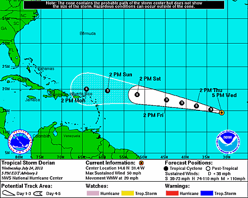
5 PM Update – Tropical Storm Dorian Continues West Across the Atlantic
Not a whole lot to report this evening with regards to Tropical Storm Dorian. TS Dorian is located 505 miles west of Cape Verde Islands moving west-northwest at 20 mph with maximum sustained winds around 50 mph and pressure holding steady at 1002 mb. Slight weakening is still expected on Thursday with some re-intiensification over the weekend. The latest intensity models forecast 60 mph winds as TS Dorian approaches the Caribbean on Monday.
11 AM Update – Tropical Storm Dorian Becomes 4th Named Storm in 2013
As expected, tropical depression four has intensified this morning and based on satellite analysis the Nation Hurricane Center upgraded, and named the system Tropical Storm Dorian. Dorian is the fourth named storm of the 2013 Hurricane Season. TS Dorian is located approximately 410 miles west-southwest of the Cape Verde Islands and remains on a west-northwest track moving at 21 mph. The tropical cyclone’s estimated central pressure dropped to 1002 mb and the maximum sustained winds have increased to 50 mph with gusts up to 63 mph. Satellite imagery and data suggest that tropical storm force winds are extending outward up to 45 miles from the center of circulation.
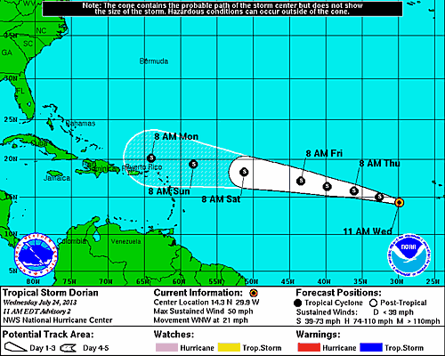
Slight strengthening is possible this afternoon followed by a gradual weakening while still maintaining tropical storm status on Thursday as TS Dorian moves over cooler parts of the Atlantic Ocean.
5 AM Update – TD4 Forms over the Eastern Atlantic
The tropical wave that emerged off the coast of Africa over the weekend had a good chance of becoming a tropical cyclone, and sure enough early this morning it was classified as a tropical depression by the Nation Hurricane Center based on satellite analysis. As of 5 AM TD4 was positioned about 300 miles west of the Cape Verde Islands moving West Northwest at 20 mph with maximum sustained winds of 35 mph and a central pressure of 1008 mb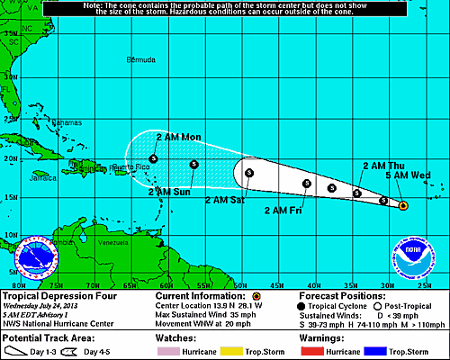 Early model runs, for the most part are in agreement showing the tropical depression continuing on a west-northwestward track.
 While the forecast track models are in agreement, the intensity models for TD4 do not form a concensus. The system will be moving into cooler waters, and encountering dryer air in the next day or so which will help keep the system under control pending any atmospheric changes. As a result, the NHC is only predicting slight intensificaiton with the 5 day forecast predicting the possibility of maximum winds reaching 45 mph. It is very likely that this tropical depression will become Tropical Storm Dorian later today. The next complete advisory from the Hurricane Center will be at 11 AM. Do to the position of the storm there are no recon flight schedule for today or tomorrow.
We will be following this system closely, as the Disney Fantasy is scheduled to sail on an Eastern Caribbean itinerary next week. It is important to keep in mind that these tropical systems are constantly changing so what you just read will change significantly by the time the system completes her transatlantic voyage.
System History
| Date | Time | Classification | Max Winds (mph) | Movement/Speed | Pressure (mb) |
| July 24 | 5AM EST | Tropical Depression | 35 | WNW at 20 mph | 1008 |
| 11AM EST | Tropical Storm | 50 | WNW at 21 mph | 1002 | |
| 5PM EST | 50 | WNW at 20 mph | 1002 | ||
| 11PM EST | 50 | WNW at 20 mph | 1002 |