
5 PM Update – Goodbye Chantal
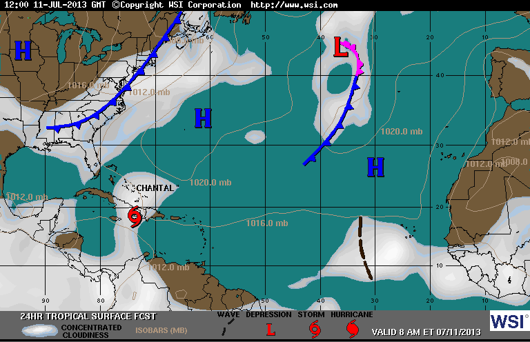
As of 5PM Tropical Storm Chantal is no more. Chantal is now a remnant low with a minimum central pressure of 1012 mb (increasing) with winds upwards to 45 mph. She continues to move west at 23 mph with the potential to produce heavy rains and gusty winds. All previous tropical storm watches and warnings have been discontinued. The remnant low is still expected to travel through Jamaica and eastern Cuba tonight and on Thursday. By Friday, the low should arrive in the northwestern Bahamas or near South Florida.
This is the last update on Chantal. Although, re-development is unlikely, the Hurricane Hunters are scheduled to investigate the low in the next day or so if conditions deem necessary.
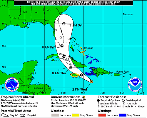
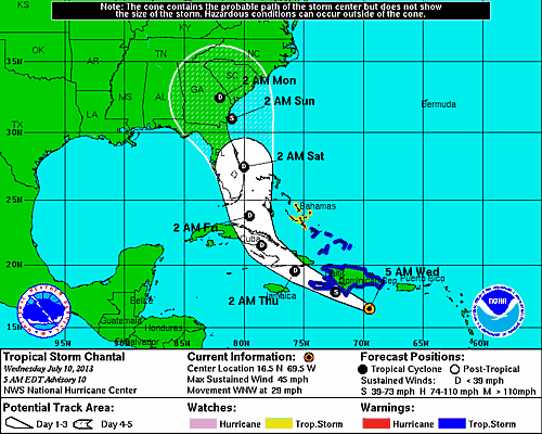
2 PM Update – Where’s Chantal?
As of 2:00 PM EDT Wed Jul 10 the center of Chantal was located 270 miles East Southeast of Kingston, Jamaica with moving West at 29 mph. The minimum central pressure was 1011 mb with maximum sustained winds of about 45 mph. Hurricane Hunters are working hard to find the center of circulation this afternoon. This is a good sign that she is weakening. In fact, the current recon flight is suggesting that Chantal is degenerating into a tropical wave.
11 AM Update – CONFIRMED: Chantal is Still a Tropical Storm
Strike that, reverse it… The is she, or isn’t she saga a Tropical Storm Chantal continues this morning. Earlier, Chantal looked to be on the way out, but the Hurricane Hunters’ recon flight confirmed that Chantal is still a tropical storm after observing closed circulation. The center of Chantal continues to move westward at 29 mph thus shifting her forecast track to the west away from the Bahamas. As of the latest update, Chantal is producing winds upwards of 45 mph with tropical storm force winds extending outward 105 miles to the North and East of her center.
The shift to the West caused the Government of Jamaica to issue a tropical storm watch.
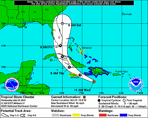
The estimated central pressure remains steady at 1011mb. Chantal looks to weaken over the next 24 hours into a tropical depression or even further to a tropical wave as she approaches Southern Cuba Thursday morning. What remains of Chantal following her trek across Cuba will emerge over the Florida Straits Thursday night en route to South Florida and back into the Atlantic.
A Tropical Wave in the Atlantic
There is a tropical wave out in the Atlantic that I’m keeping an eye on which continues to produce disorganized showers. The probability for this area develop is at best 5%, but still worth keeping on the radar as the Fantasy will be sailing on an Eastern Caribbean itinerary next week.
8 AM Update – Chantal Likely A Tropical Wave
Tropical Storm Chantal may be on the outs. The Hurricane Hunters are en-route to determine the status of Chantal. If the recon flight verifies that Chantal has degenerated into a tropical wave then all watches and warning will be discontinued later this morning.
Chantal is still moving to the west at 29 mph with maximum sustained winds of 45 mph.
Elsewhere, there is a system of disorganized weather in the East Atlantic that may have the potential over the next 48 hours to develop.
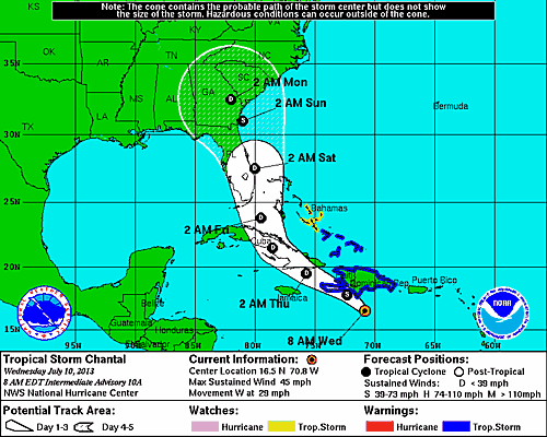
5 AM Update – Chantal Weakening
Tropical Storm Chantal continues to move at a brisk 29 mph, but has weakened considerably overnight with maximum sustained winds dropping to 45 mph and an increase in central pressure to 1011mb. Presently, there is a tropical storm warning for the Dominican Republic, Haiti, Turks and Caicos, and the Southern Bahamas. A tropical storm watch is in effect for the Central Bahamas.
Chantal course and intensity forecast has changed considerably since last night. The latest forecast for Chantal tracks her much further west, moving through Haiti and a most of Cuba before turning north towards South Florida on up the Atlantic Coast.
A decrease in forward speed is expected today along with additional weakening. Chantal could degenerate into a tropical wave later today based on observations by the Hurricane Hunters, surface observations, and satellite imagery which is showing her becoming disorganized.
Chantal is loosing steam and could very well be gone later today.