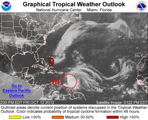
Tropical Storm Patty continues to hang around this afternoon. As of 11 AM TS Patty was 275 miles east-northeast of the Central Bahamas moving northeast at 2 mph with maximum sustained winds of 40 mph. TS Patty is expected to weaken throughout the afternoon as strong southwesterly winds will dampen Patty’s circulation.
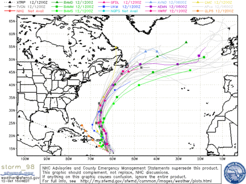
Invest 98L continues to organize over the Eastern Caribbean Sea approximately 100 miles west of Dominica.. Strong winds with gusts up to 47 mph have been reported in the Lesser Antilles. It is likely that 98L will become a tropical depression or a tropical storm sometime during the next 48 hours as upper level winds become more conductive for development. Forecast models show a projected path northwestward at 10-15 mph then turning to the north-northeast towards Bermuda.
Strong winds and heavy rain are possible across portions of the Lesser Antilles and the Virgin Islands through this weekend. An Air Force Reserve Hurricane Hunter plane will be investigating the system this afternoon.


