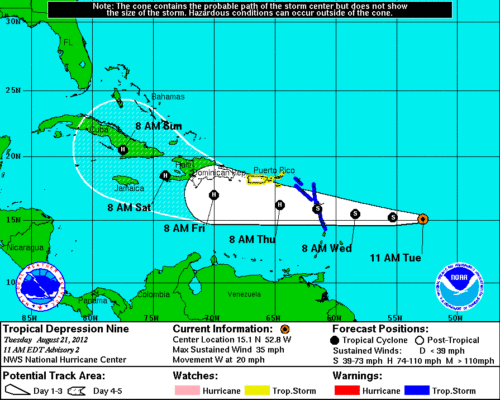
Over the weekend, I began following Invest 94L, and early this morning the system intensified into a Tropical Depression. Tropical Depression 9 is expected to become Tropical Storm Isaac later today. The system is moving west towards the Lesser Antilles at 20 MPH with maximum sustained winds of 35 mph. The system is expected to develop into a Category 1 hurricane early Thursday morning, as it enters the Easter Caribbean waters. Then, by Sunday 8/26/2012, the hurricane is expected to intensify into a Category 2 hurricane as it reaches Cuba.
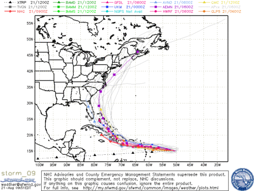
The models are mostly in agreement between now and Sunday. The GFS model has the center of the hurricane headed for South Florida.
The future forecasts estimate a course through the Bahamas, continuing up the East Coast of the United States. This could pose problems for 3 of the ships in the Disney fleet. The [Disney_Dream] will be finishing up a 5-Night and starting a 4-Night Bahamian cruise when the hurricane reaches Florida. The [Disney_Magic] will be arriving in the Bahamas from New York City the middle of next week. Finally, the [Disney_Fantasy]’s is scheduled on an Eastern Caribbean which should be OK as long as there is no storm damage to St. Thomas, or to St Maarten. By the weekend we should have a better idea of Isaac’s projected path.
Looking Forward
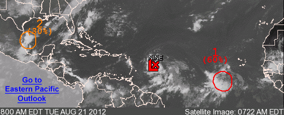
It seems Mother Nature has big plans for the end of August. Following the current system is another well-defined low pressure system with a 60% chance of becoming a tropical depression over the next 48 hours.
UPDATE
This afternoon TD9 intensified into Tropical Storm Isaac. Check back tomorrow for an updated forecast.


