
Hurricane Sandy – Latest Imagery (REPLAY)
11 PM Update
Again, not much of a change. Sandy is still barely a hurricane at 75 mph. Presently Sandy is 90 miles north of Great Abaco. The big news is the current size of Sandy, hurricane force winds are extending outward up to 70 miles, and tropical storm force winds are reaching out to 415 miles!
8 PM Update
Not much has changed over the past 3 hours. Sandy is still a category 1 hurricane with 75 mph winds moving north away from Great Abaco at 7 mph.
5 PM Update
Hurricane Sandy is slowly moving away from Great Abaco Island this evening. She remains a category 1 hurricane with maximum sustained winds of 75 mph and is moving to the north at 7 mph. A weather station on Grand Bahama Island recorded maximum sustained winds of 49 mph, and a gust of 63 mph. Slight weakening is expected over the next couple days.
The present forecast in Nassau for Saturday is calling for a 30-40% chance of showers and up to 30 mph wind with a high of 83.
The Dream and Fantasy are both back within AIS range west of Miami.
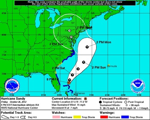
2 PM Update
Hurricane Sandy has weakened a bit this afternoon and is just barely holding onto hurricane strength at 75 mph. She is located about 30 miles north-northeast of Great Abaco Island moving to the north at 7 mph.

The Government of the Bahamas has downgraded the hurricane warning with a tropical storm warning for the Northwest Bahamas. Hurricane force winds are still extending outward 35 miles with tropical storm force winds reaching 275 miles.
Sandy will continue on her current heading overnight. Saturday it looks like she will take a turn to the north-northeast and pick up some forward speed before heading northeast on Sunday.
11 AM Update
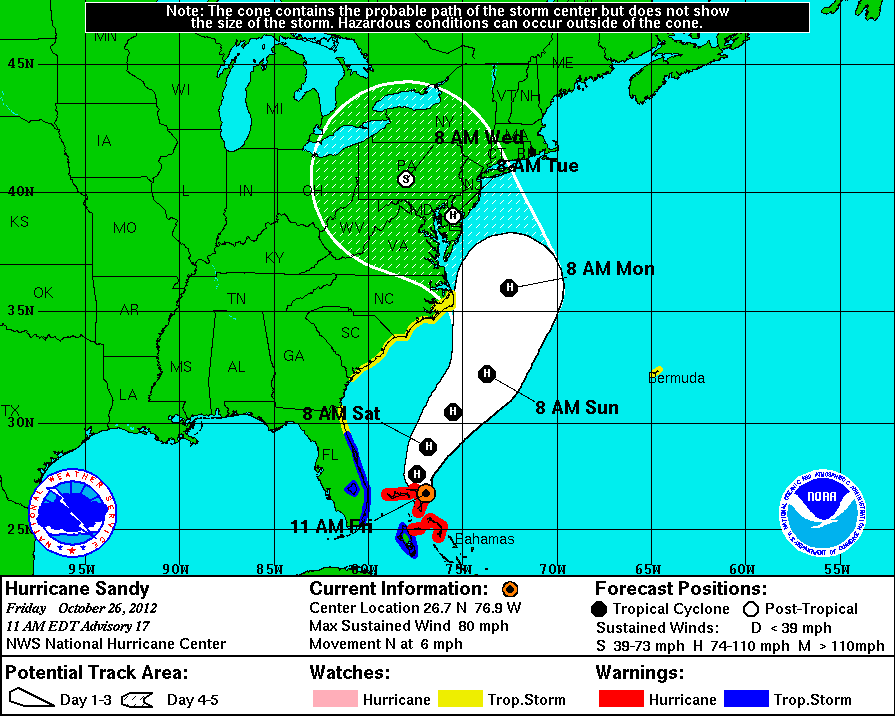
Hurricane Sandy slowly moving northward past Great Abaco Island. Winds remain at 80 mph.
Hurricane warning remains in effect for Castaway Cay. All warnings and watches have been discontinued for the Florida Keys, which is where the Dream was heading to escape the bad weather.
8 AM Update
Hurricane Sandy is now 15 miles east of Great Abaco Island. She has slowed down to 10 mph and remains on a northwest heading. The maximum sustained winds are still at 80 mph. The forecast indicates that she will continue to slow down while maintaining hurricane strength.
Hurricane force winds are extending 35 miles and tropical storm force winds are reaching 275 miles from the center.
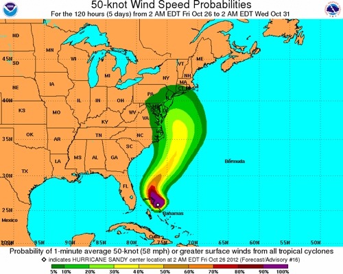
As a result of the wind field, Castaway Cay is more than likely receiving strong tropical storm force winds.
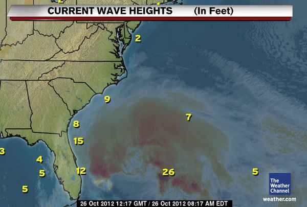
Waves heights of 12 to 15 feet have been recorded off the east coast of Florida. An offshore buoy has recorded 26 foot waves.
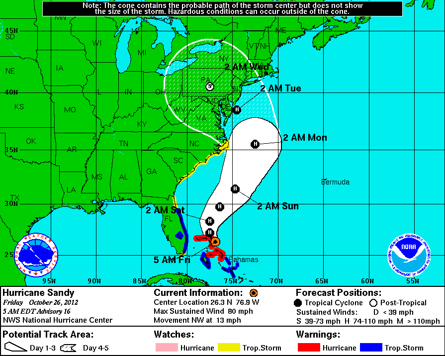
5 AM Update
Sandy is passing to the east of Abaco Isaland, near Castaway Cay on a northwest heading at 13 mph. She is a weak category 1 hurricane with 80 mph winds. Although, Sandy’s winds are slowing, her size is growing. Hurricane force winds are extending 35 miles and tropical storm force winds are reaching 275 miles from the center.
Scott, Please give your input as to what these wave heights might mean for the Saturday departure of the Disney Fantasy from Port Canaveral as she departs for her Western Caribbean itinerary. Thank you!