Isaac & Joyce
This post will most likely be the last update on Isaac and Joyce, as both systems will no longer be a direct threat to the Bahamas. As I previously mentioned, the seas may be a little rough with Isaac to the west and Joyce to the east. As you are heading to Port Canaveral for today’s 5-Night on the [Disney_Dream] it may be a good idea to stop for some anti-emetics, or Sea-Bands just in case.
Invest 97L
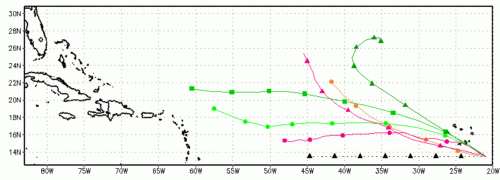
A modest tropical wave south of the Cape Verde Islands (off the West Coast of Africa) is now being tracked as Invest 97L. Some development is possible over the next couple of days as 97L moves to the west-northwest at 10-15 MPH. NHC has given the system a 30% chance of becoming a tropical depression over the next 48 hours.
11 AM Update
- Joyce has degenerated into a remnant low
- Isaac is beginning to stretching with 60 MPH maximum sustained winds, 5-day has shifted east
- 97L is still at 30%
- The next named storm will be Kirk
5 PM Update
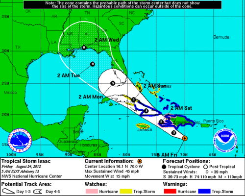
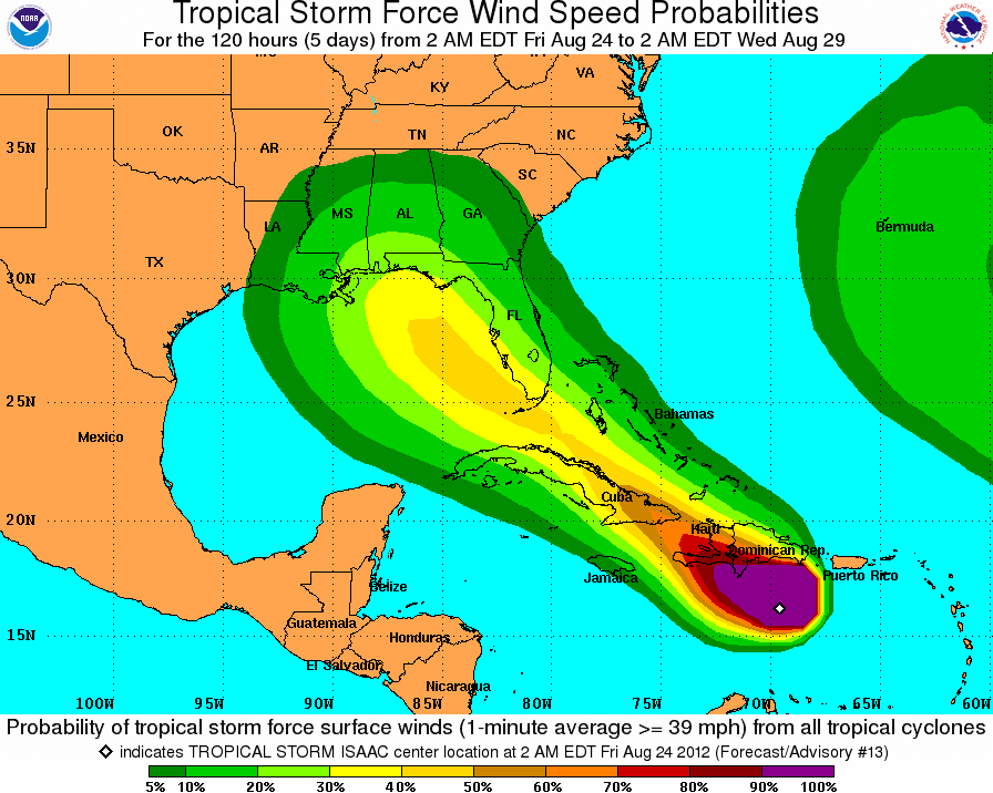
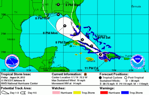
- Isaac’s winds have increased to 65 MPH moving to the northwest at 16 MPH. The system is expected to weaken a bit as it moves over land before he returns to open water on his way to the Florida Keys.
- Tropical storm watch (below in yellow) is in effect for the Florida Keys, Florida’s East Coast south of Jupiter Inlet, Florida’s West Coast Sout of Nonita Beach, Florida Bay, and Lake Okeechobee.
- The Government of the Bahamas has issued a tropical storm watch (below in yellow) for the northwestern Bahamas including the Abacos Islands, which includes Castaway Cay, and New Providence (Nassau).
11 PM Update
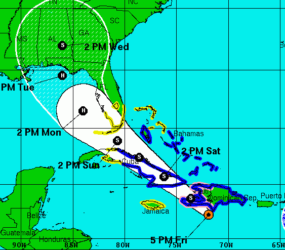
- Isaac’s winds have increased to 70 MPH as it is getting better organized, and is moving to the northwest at 14 MPH.
- Tropical storm warning(below in blue) is in effect for the Florida Keys, Florida’s East Coast south of Jupiter Inlet, Florida’s West Coast Sout of Nonita Beach, Florida Bay, and Lake Okeechobee.
- Hurricane Watch (below in pink) has been issued for all of the Florida Keys, Florida Bay, and for the coast of the Southern Florida peninsular from ocean reef to the east coast westward to Bonita Beach on the west coast.
- The Government of the Bahamas has issued a tropical storm warning (below in blue) for all of the the northwestern Bahamas including the Abacos Islands, which includes Castaway Cay, and New Providence (Nassau).

