
Hurricane Season Forecast 2013
The Atlantic hurricane season, which runs from June through November, is fast approaching. Last week, Colorado State University’s Department of Atmospheric Sciences published their annual hurricane forecast, and it looks to be quite an active year in the Atlantic.
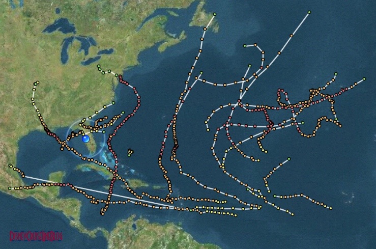
The 2012 hurricane season was considered above average with 19 tropical storms, of which 10 grew to hurricanes.
The Colorado State forecast predicts an above average probability for a major hurricane making landfall along the United States coastline and in the Caribbean. The tropics have unexpectedly warmed over the last few months; and, with a low probability of an El Niño event occurring this summer, the conditions this fall will become increasing favorable for tropical cyclone development. (El Niño is a period of abnormally warm sea surface temperatures occurring in the Pacific Ocean, which reduces wind shear in the Atlantic Ocean. With a decrease in wind shear, the conditions become more favorable for hurricane development as an increase in wind shear impedes development.)
The forecast anticipates 18 named storms with half being of hurricane strength and four developing into major hurricanes (category 3 or higher). The forecast comes in well above the average, which is calculated based on a historical data from 1981-2010. The estimated number of days in which there will be an active named storm is 95 days, 35 days above the average. The number of those days in which a there is an active hurricane is almost double the average at 40 days. The probability for a major hurricane to make landfall along the US coastline is 72% the average for the last century was 52%. The probability for a major hurricane to track into the Caribbean is up 20% from the century average to 61%.
2013 Tropical Cyclone Names
| Andrea | Gabrielle | Melissa | Tanya |
| Barry | Humberto | Nestor | Van |
| Chantal | Ingrid | Olga | Wendy |
| Dorian | Jerry | Pablo | Greek Alphabet |
| Erin | Karen | Rebekah | |
| Fernand | Lorenzo | Sebastien |
National Hurricane Center Policy Changes for 2013
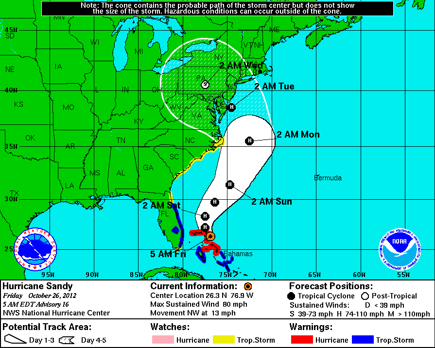
The National Hurricane Center announced some policy changes that will be implemented this hurricane season. Most importantly, the National Hurricane Center has revised their definitions for tropical storm and hurricane watch and warnings have been modified. The change in verbiage will now allow the National Hurricane Center to issue or to keep in effect watches and warnings after a tropical cyclone becomes post-tropical when there is potential for the system to pose a substantial threat to lives and property and when the transfer of responsibility to another Weather Service office would result in a lapse in service. This change is directly attributed to last seasons’ Hurricane Sandy, which became post-tropical well before she made landfall in New Jersey.
The National Weather Service issued a final advisory on October 30, 2012 passing the baton over to the National Weather Service’s Weather Prediction Center. On April 11, 2013, the World Meteorological Organization’s hurricane committee retired the name Sandy from the official list of Atlantic Basin tropical cyclones due to the extreme impacts she caused from the Caribbean to the East Coast of the United States. Normally, tropical cyclone names are reused every six years; in her place in 2018 will be Sara.
The revised tropical storm & hurricane definitions are as follows:
- Hurricane Warning: An announcement that sustained winds of 74 mph or higher are expected somewhere within the specified area in association with a tropical, subtropical, or post-tropical cyclone. Because hurricane preparedness activities become difficult once winds reach tropical storm force, the warning is issued 36 hours in advance of the anticipated onset of tropical-storm-force winds. The warning can remain in effect when dangerously high water or a combination of dangerously high water and waves continue, even though winds may be less than hurricane force.
- Hurricane Watch: An announcement that sustained winds of 74 mph or higher are possible somewhere within the specified area in association with a tropical, subtropical, or post-tropical cyclone. Because hurricane preparedness activities become difficult once winds reach tropical storm force, the watch is issued 48 hours in advance of the anticipated onset of tropical-storm-force winds.
- Tropical Storm Warning: An announcement that sustained winds of 39 to 73 mph are expected somewhere within the specified area within 36 hours in association with a tropical, subtropical, or post-tropical cyclone.
- Tropical Storm Watch: An announcement that sustained winds of 39 to 73 mph are possible somewhere within the specified area within 48 hours in association with a tropical, subtropical, or post-tropical cyclone.
Additionally, the tropical cyclone forecast cone will be reduced in size providing a more defined forecast track.
The National Hurricane Center is expected to release their forecast sometime in May, closer to the start of hurricane season. For those keeping score, the Atlantic hurricane season is 6 months; that is half of the year. Sure, you should be aware of the weather around you, but I would not let predictions such as these (or hurricane season itself) deter you from making vacation plans.
“Sure, you should be aware of the weather around you, but I would not let predictions such as these (or hurricane season itself) deter you from making vacation plans.”
You obviously were not on the Fantasy during Sandy!! 😉
Kelsey, you are correct, I was not on the Fantasy during Sandy. I have two cruises booked during hurricane season.
Or on the Dream as I was. I hope DCL learned from their mistakes during Hurricane Sandy and will make better decisions during the coming hurricane season. Our trip was absolutely miserable, but could have been salvaged somewhat if better route choices had been made as the storm grew.