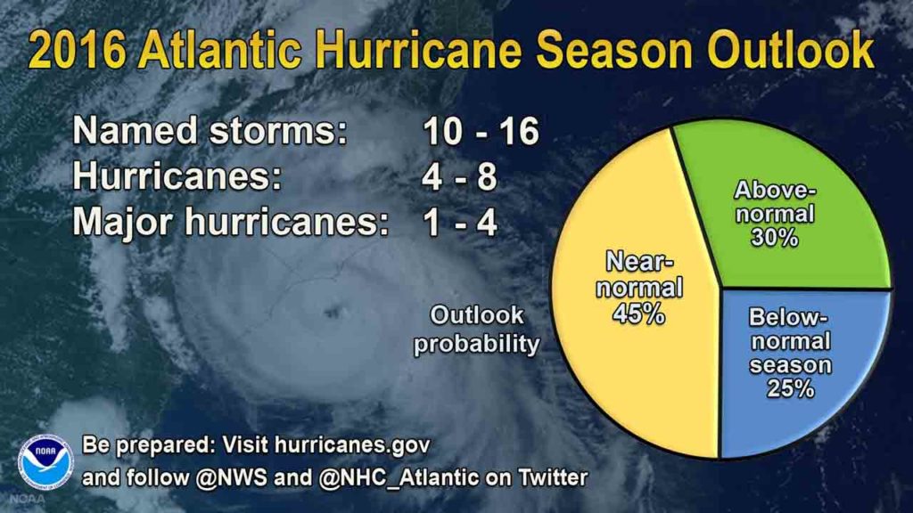
Today marks the official start of the 2016 Atlantic Hurricane Season which will continue through November. Just last week, the National Oceanic and Atmospheric Administration (NOAA) published their outlook for the 2016 Atlantic hurricane season. NOAA predicts that the 2016 Atlantic basin hurricane season will be near-normal, but forecast uncertainty in the climate signals that influence the formation of Atlantic storms make predicting this season particularly difficult.
According to NOAA’s Climate Prediction Center, there is a 70% chance of 10 to 16 named storms with 4 to 8 of those becoming hurricanes with 1 to 4 major hurricanes (category 3 or higher). The prediction is up over the past three years which were below normal.
The 2016 count began early this year with two named storms to date; Alex, a rare January hurricane and tropical storm Bonnie late last week.
Below is a comparison of the NOAA and Colorado State University’s predictions along with the 1981-2010 average and final numbers for 2012-2015. As you can see, the 2016 predictions are mostly below the long term average with exception of NOAA’s high side range. Additionally, CSU’s and NOAA’s low end predictions bookend the 2015 hurricane season actual numbers.
El Niño – La Niña Influence on Hurricane Season
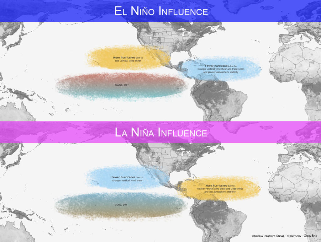
El Nino helped keep systems at bay in 2015 is going away. In fact, it was one of the strongest El Niños on record, but it is dissipating leading forecasters suggest a 70% likelihood of La Niña being present for the peak months between August and October (a 75% chance by the fall). This could become a key factor during the peak months as, La Niña suppresses hurricane activity in the central and eastern Pacific Ocean, and enhances development in the Atlantic Ocean.
El Niño is a 12-18 month period with warmer sea surface temperatures occur in the eastern half of the Pacific Ocean near the equator. El Niño favors stronger hurricane activity in the central and eastern Pacific Ocean, and suppresses activity in the Atlantic Ocean. Moderate to strong El Niño events are irregular, occurring maybe once every 3 to 7 years. In contrast, La Niña suppresses hurricane activity in the central and eastern Pacific Ocean, and enhances development in the Atlantic Ocean. For more on the the subject check out a great article from 2014 at Climate.gov.
2016 Atlantic Basin Tropical Cyclone Names
- Alex
- Bonnie
- Colin
- Danielle
- Earl
- Fiona
- Gaston
- Hermine
- Ian
- Julia
- Karl
- Lisa
- Matthew
- Nicole
- Otto
- Paula
- Richard
- Shary
- Tobias
- Virginie
- Walter
- Followed by the greek alphabet, if needed.
It is important to keep in mind that this annual forecast is a prediction, not what will happen. Mother Nature can, and will do whatever she wants and even the best forecast models will be thrown for a loop. It is imperative to stay alert in the event a system develops and for those living in coastal areas to be prepared.
We will continue to track tropical systems that have the potential to impact cruise itineraries as well as frequent Caribbean and Bahamian ports of call. We strive to provide accurate and updated information, but ultimately the best source of up to date information on these systems the National Hurricane Center and your local National Weather Service offices. Basically, what I am saying is that we should not be used as official forecast information. The goal is to share the information from the NHC and how it relates or impacts it may have on the sailings and ports of call.
We have been covering hurricane season since the website launched and have a dedicated Tropical Weather page. However, I’d like to take this opportunity to hear your feedback on what level of coverage you’d you like to see reported on the site and Twitter?


