
As we reach the peak of the 2014 hurricane season we have a number of areas in both the Pacific and Atlantic Oceans to keep an eye on this week. As far as the Tropical Atlantic, a new tropical depression developed just before the lunch hour and is forecast to strengthen into a Tropical Storm Edouard by morning and potentially strengthen into a hurricane early next week as it moves over the open Atlantic waters. Normally, we would not track a tropical cyclone that is forecast to remain at sea, but the Disney Magic is currently in Tenerife on day 6 of her 14-Night Westbound Transatlantic cruise. The Magic will spend the next five days at sea en-route to St John’s, Antigua as the crew does their best to avoid the system.
The NHC is also monitoring a weak area of low pressure (Invest 92L) near the northwestern Bahamas. The environment is not conductive for development and the Hurricane Hunter recon flight previously schedule for today has been canceled. Although, significant development is unlikely the low is slowly moving toward the east coast of Florida and is expected to bring heaving rains to portions of south Florida. The Disney Dream is in Port Canaveral today and will set sail this evening on a 3-nigth Bahamian cruise.
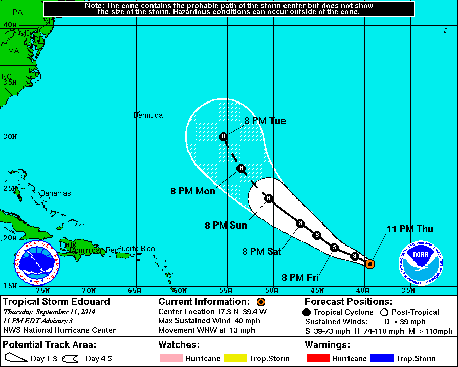
11 PM Update | Tropical Storm Edouard Forms in the Far East Atlantic
Tropical Storm Edouard formed approximately 1020 miles west of the Cape Verde Islands with maximum sustained winds of 40 mph. The system is moving to the west-northwest at 13 mph. Tropical storm force winds are extending outward up to 45 miles, primarily to the north of the center. The National Hurricane Center’s forecast continues to keep Edouard
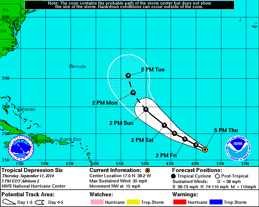
5 PM Update | Tropical Depression 6 Moving Northwest Over Tropical Atlantic
TD6 is now approximately 940 miles west of the Cape Verde Islands with maximum sustained winds of 35 mph. The system is moving to the northwest at 15 mph. The National Hurricane Center’s forecast suggests the tropical depression will strengthen into Tropical Storm Edouard tonight. Then, potentially strengthen into a hurricane early next week as it moves over the open Atlantic waters.
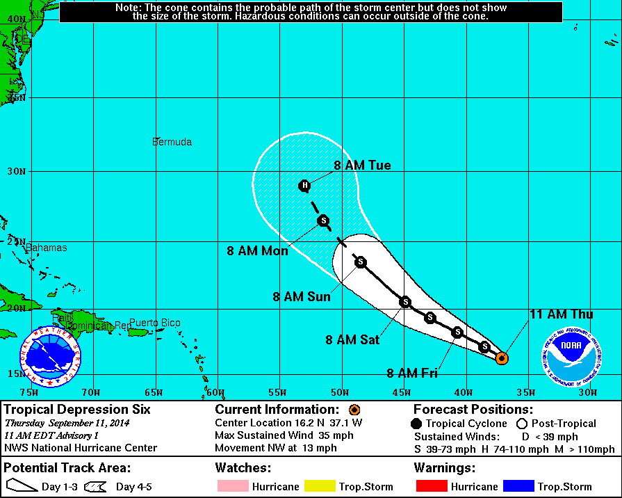
11 AM Update | Tropical Depression 6 Forms West of Cape Verde Islands
TD6 developed approximately 870 miles west of the Cape Verde Islands with maximum sustained winds of 35 mph. The NHC is forecasting that the tropical depression will strengthen into Tropical Storm Edouard by morning and potentially strengthen into a hurricane early next week as it moves over the open Atlantic waters. While there a no coastal waters or warnings in effect, the Disney Magic will be crossing the Atlantic Ocean during the next five days.
Tropical Cyclone History | Edouard
This table contains the NHC’s statistics for the tropical cyclone from each advisory.
| Date | Time (EST) | Classification | Max Winds (mph) | Movement/Speed | Pressure (mb) |
| Sep 7-11 | Invest 91L | ||||
| Sep 11 | 11 AM | Tropical Depression (TD6) |
35 | NW at 13 mph | 1007 |
| 5 PM | 35 | NW at 15 mph | 1006 | ||
| 11 PM | Tropical Storm | 40 | WNW at 13 mph | 1005 | |