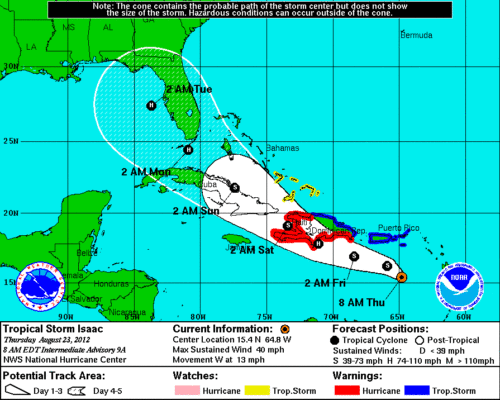
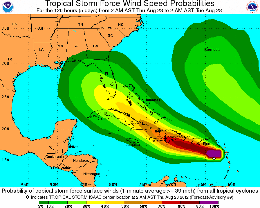
Tropical Storm Isaac is moving westward though the Eastern Caribbean Sea at 13 MPH with maximum sustained winds near 40 MHP. Tropical storm force winds are extending from the center, outward up to 140 miles. The center will pass to the south of the US Virgin Islands (currently under a tropical storm warning) today with winds ranging from 10 to 40 MPH extending to St Thomas. The tropical storm warning has been discontinued for St. Maarten.
Isaac will begin to change course to the west-northwest this evening on into Friday, and is expected to become a hurricane on before it reaches Hispaniola.
The models continue to look promising for the upcoming cruises, with Isaac tracking into the Gulf of Mexico. However, the outer wind and rain bands combined with Tropical Depression 10 (which will most likely become Joyce later today) Tropical Storm Joyce could generate some rough seas. It may be a good idea to pick on some antiemetics, or Sea-Bands just in case.
Check back later today as I will update this post with any future developments.
UPDATES
- Tropical Depression 10 is now Tropical Storm Joyce with 40 MPH winds
2PM Update
- Rebecca Peddie, manager of public affairs Disney Cruise Line, told The Weather Channel that none of the company’s ships have altered their course just yet.
“At this time, we have not made any modification to the itineraries for our three ships … sailing in the Caribbean this week,” said Peddie. “The safety of our guests and crew is our first priority at Disney Cruise Line, and we continually monitor any storm’s progress very closely.”
- Isaac is now moving west-northwestward south of Puerto Rico at 15 MPH with maximum sustained winds of 40 MPH.
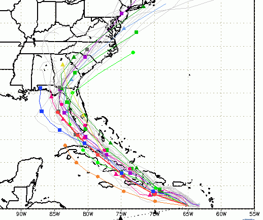
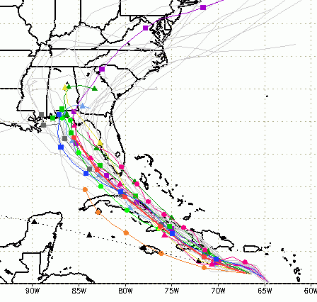
- The models continue to show Isaac moving towards Key West and into the Gulf of Mexico.
4PM Update
It seems that Isaac is having some trouble organizing. The cyclone has a well-defined outer circulation, but the inner core has yet to develop. Previously, Isaac was expect to intensify into a hurricane by the time he arrived Hispaniola, but the latest models keep him as a tropical storm until he reaches the Gulf of Mexico. While the official forecast does not show Isaac strengthening the conditions remain favorable for rapid intensification which could happen at any time if the inner core becomes more defined.
The latest spaghetti models have all shifted the track away from Florida’s Gulf Coast moving potential outer wind bands further away from the Bahamas. This still keeps the probability of rain at Walt Disney World over 50% for next week.


